Updated: 5th July 2021
The City of Blue Mountains is a confederation of more than 20 townships and localities, formed in 1947. The city is located within the boundaries of the national park. The principal centres are Katoomba, Leura, Mount Victoria, Blackheath, Springwood, Wentworth Falls, and Lawson, all of which lie on both the rail line and Great Western Highway between Sydney 60 km east) and Lithgow on the western slopes of the mountains. Urban growth has been rapid, as the area is a popular vacation centre.
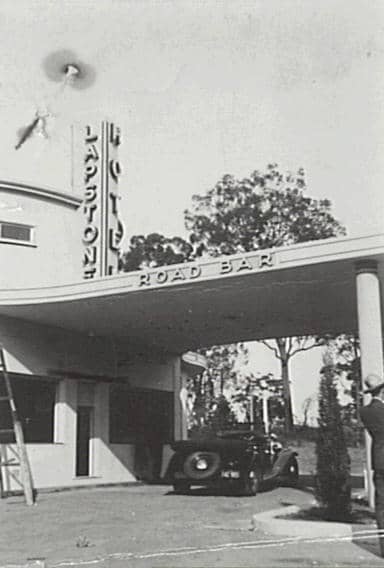
Lapstone (106m)
The name “Lapstone Hill” was in use from at least the 1820s and derives from the shape of numerous water worn stones in the area which were once a part of the bed of the ancient Nepean River. To road workers and travellers they resembled the lap stones used by cobblers. In 1822 Mrs Elizabeth Hawkins, on her way to Bathurst, wrote: “We now began our ascent up the first Lapstone Hill, so called from all the stones being like a cobbler’s lapstone.” It was not until 1964, with the subdivision of Arthur Hand’s estate, that a railway station was established with the name Lapstone.
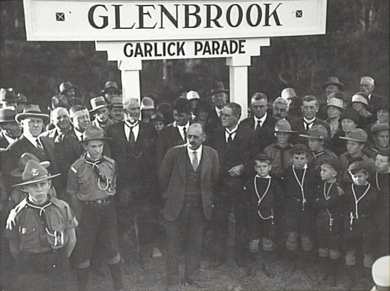
Glenbrook (163m)
The origin of this name goes back to 1818 when Sir John Jamison, while exploring the Nepean and Warragamba Rivers, named a tributary Glen Brook (now Glenbrook Creek). When the railway was built across the Blue Mountains the location became known as Watertank, a stopping place for the steam engines to draw water from the nearby lagoon. When a crossing loop was established here in 1874 (for trains to pass on the single line) the name was changed to Wascoe’s Siding and later still, with the addition of a passenger platform in 1878, to Brookdale. The name Glenbrook was given in 1879 and the Village of Glenbrook was proclaimed in 1885.
Blaxland (234m)
This area at the junction of the first three roads up the eastern escarpment was first referred to by the name of the inn, The Pilgrim, which was established here in the late 1820s. When a platform was built here on the arrival of the railway in 1867 it became known as Wascoe’s after the licensee of the inn, John Outrim Wascoe. The name of Blaxland was assigned in 1879, in memory of the explorer Gregory Blaxland who led the expedition which found a route across the Blue Mountains in 1813.
Mount Riverview
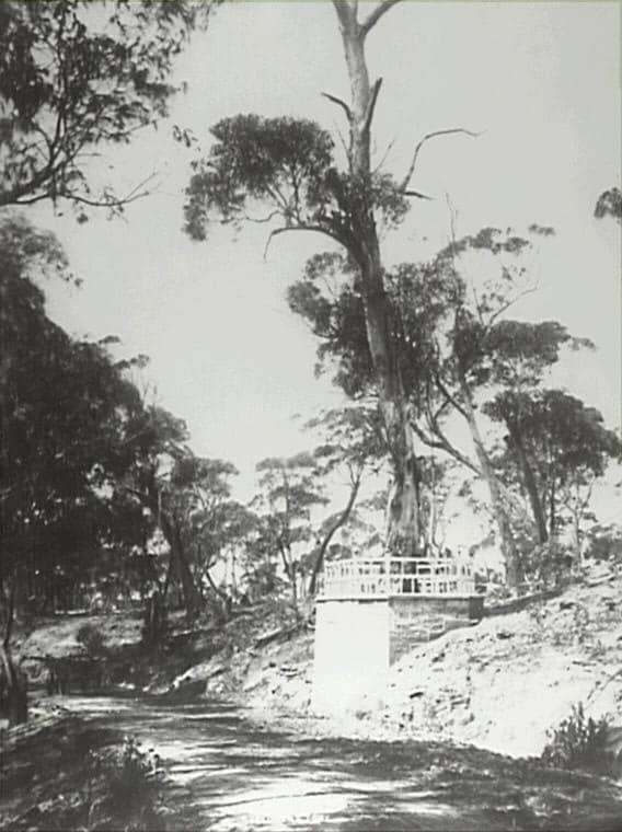
Land in this area did not go up for public sale until 1920. One of the early purchasers was Bernard Francis Cummins who appears to have named his property Mount Riverview. In 1931 he erected a lookout in a tree on his property which he advertised as the Mount Riverview Lookout. For a small fee tourists could climb the ladder to the lookout platform and obtain an expansive view of the Nepean River and beyond.
Near the lookout Cummins also ran a tearoom and an art gallery. All three, as well as his residence, were destroyed by bushfire in December 1944. In the early 1950s an attempt was made to establish a settlement for ex-servicemen promoted as the Mount Riverview Village. Further independent subdivisions followed. The name Mount Riverview was not officially gazetted, however, until April 1964.
Warrimoo (273m)
In 1881 a small timber railway platform was built approximately 500 metres west of the present railway station. This was meant to serve a new Richardson & Wrench subdivision named Karabar Estate. By the end of 1897 lack of patronage led to the closure of the Karabar platform. When the railway line was duplicated in 1902 an emergency loop and signal box was placed at Karabar but later removed during regrading work in 1913. When Arthur Rickard & Co. subdivided this area the present railway station was built (1918) and took its name from the subdivision – Warrimoo, an Aboriginal word (not local) meaning “eagle”.
Valley Heights (322m)
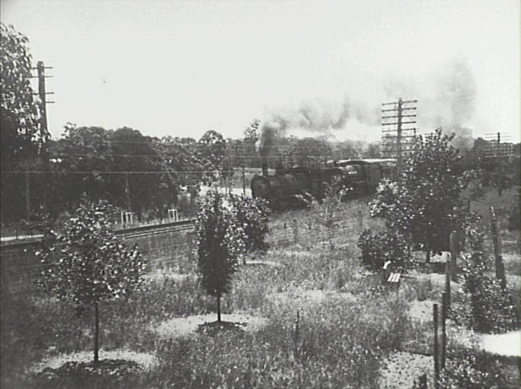
Willaim Cox referred in 1815 to “The Valley” as a suitable site for watering and feeding stock. By 1832 it had been designated as a resting place for stock and was known as Fitzgerald’s Valley (possibly after Richard Fitzgerald who Governor Macquarie had appointed Superintendent of the agricultural farm at Emu Plains in 1819). Above the valley on the Western Road an inn was opened in 1831 under the name The Valley Inn (later known as The Woolpack and The Welcome Inn). With the arrival of the railway the inn closed and was sold to the Hon. Geoffrey Eagar MLA. A railway platform was opened as Eagar’s Platform in 1875. This became The Valley in 1877 and Valley Heights in 1880. A steam locomotive depot operated here from 1913 until the electrification of the railway line in 1957. The actual valley itself is now known as Sun Valley.
Springwood (371m)
This location was named by Governor Lachlan Macquarie when he camped here on his outward journey over Cox’s new road in April 1815. He wrote in his journal: “We then haulted at three o’clock in a very pretty wooded plain near a spring of very good fresh water, and pitched our tent near the side of the road. The place being very pretty I have named it Spring-Wood.” In 1816 a military depot was established near the site of this camp.When the military presence was eventually withdrawn in the early 1840s, Thomas Boland built the Springwood Inn. During the period of the military stackade and Boland’s Inn, Springwood was a popular stopping place for travellers along the Western Road and, particularly during the gold rush which began in the early 1850s, became at times a huge encampment of tents etc. Following the construction of the railway, Springwood became popular with the wealthy citizens of Sydney as a place to build their country homes.
Winmalee (305m)
This area was originally known as North Springwood until, in 1969, the Geographical Names Board made the decision to seek a new name. As the result of a community competition the name Winmalee was chosen and became official in 1972. The word is said to be of Aboriginal origin (not local) and to mean “in a northerly direction”.
Faulconbridge (447m)
Sir Henry Parkes bought 600 acres of land here in 1876 and named his residence Faulconbridge, the maiden name of his mother. A railway platform with this name was built to service his needs in 1877. Parkes, his first wife and two of his sons are buried in the cemetery he established here.
Linden (526m)
This location was originally known as Seventeen Mile Hollow. A toll house and turnpike gates were erected here in 1849. The toll keeper, Thomas Ellison, acquired some 5 acres of land adjacent to the toll bar and built an inn here ca1857. The toll house, gates and inn were all demolished during the railway works of the mid-1860s. In 1874 a railway platform was constructed here and took its name from the nearby Linden House, a private residence only recently erected by businessman William Henderson.
Woodford (607m)
This location was first referred to as Twenty Mile Hollow. In the early 1830s an inn called The Woodman was opened. During the 1840s this inn became known as The King’s Arms and, when its last licensee William Buss took over in 1855, it was popularly referred to as Buss’s Inn. When the railway arrived in 1867 the first station also took the name of this popular publican. However, the inn was soon sold to Alfred Fairfax, a Sydney jeweller, who converted it into a private residence and renamed it Woodford House. The railway station was renamed Woodford in 1871. Woodford House eventually became the Woodford Academy, a private school for boys. It is now in the hands of the National Trust.
Hazelbrook (674m)
In the 1870s a private residence, Hazelbrook House (nolonger in existence), was built by Edward Higgs on the south side of the railway line. When a railway station was opened opposite it in 1884 the name Hazelbrook was adopted. There is a popular view, unsubstantiated by other than oral evidence, that Hazelbrook House took its name from a “Hazel Brook” flowing in the area that in turn got its name from “hazel-like trees” growing nearby.
Lawson (732m)
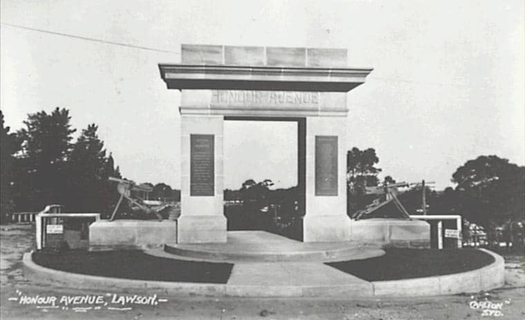
This location appears in early references as The Swamp or Christmas Swamp and, in the 1830s, as Twenty Four Mile Hollow. Following the opening of Henry Wilson’s Blue Mountain Inn in the mid-1840s the area became popularly known as Blue Mountain, a name adopted by the railway when a station was opened here in 1867. The name of the town and its railway station was changed to Lawson in 1879 in honour of William Lawson, the explorer.
Bullaburra (769m)
Much of the land here was originally owned by Sir Henry Parkes who named the locality The Village of Colridge. In the 1920s Arthur Rickard & Co. opened a large subdivision here and gave it the name of Bullaburra, an Aboriginal (not local) word said to mean “blue sky” or “fine weather”. The railway station opened with this name in 1925.
Wentworth Falls (867m)
In May 1815 William Cox, while building a road over the Blue Mountains, erected a “weatherboard hut” as a supply depot here. Subsequently, the locality became popularly known as The Weatherboard and that name was adopted by the inn which opened here in the mid-1820s (though its official name appears to have been The Bathurst Traveller until at least the mid- 1840s). A mounted police station was also located here from the early 1830s until 1855. A railway station was opened as Weatherboard in 1867 and, along with the township that gradually grew around it, was given the name of Wentworth Falls in 1879 in honour of William Charles Wentworth, the explorer.
Leura (985m)
It is said that William Eyre, who subdivided this area at the end of the 1880s, intended to call the township Lurline after his daughter. However, when the railway station was opened in 1891 it was given the name of Leura. At the end of 1892 the prestigious Leura Coffee Palace (later to become The Ritz) opened for business. It has also been suggested that “leura” is an Aboriginal word which describes the “volcanic” geology of the area.
Katoomba (1017m)
Early names given to this location include William’s Chimney and Collett’s Swamp, their origins unknown. From the mid-1830s there was also The Shepherd & His Flock Inn near Pulpit Hill to the west of present day Katoomba, where Louisa Meredith spent “a tolerablenight’s rest” on her way to Bathurst in 1839. With the arrival of the railway a platform was opened here in 1874 as The Crushers, the name referring to a nearby quarry operating to supply ballast for the railway line. Goods trains also made The Crushers a regular stop in order to adjust their loads before the run down to Penrith.
The name Katoomba replaced The Crushers in 1877, just prior to the opening of the Katoomba Coal Mine. Katoomba is said to be Aboriginal in origin, deriving from a Gundungurra word meaning “falling waters” which was probably applied by the indigenous people to all the waterfalls in the Katoomba/Wentworth Falls area that drained into the Jamison and Kedumba Valleys. Katoomba achieved municipality status in 1889, becoming the first local government area in the Blue Mountains.
Medlow Bath (1050m)
The location here of Brown’s Sawmill saw the first railway platform opened here in 1880 as Brown’s Siding, Pulpit Hill. This was changed to Medlow in 1883 to avoid confusion with another Brown’s Siding near Lithgow. The origin of the name Medlow is uncertain, the argument coming down to it being either a corruption of the Aboriginal word for Megalong or a borrowing of the name of a small town in the north of England. In any event, the name was changed again in 1903 when the addition of Bath was made to distinguish it from another Medlow in NSW and to mark the imminent opening of Mark Foy’s grand Hydropathic Bath. In the early 1900s Foy purchased three properties on the cliff edge, including the Belgravia Hotel, and incorporated them into the complex known still as the Hydro Majestic.
Blackheath (1065m)
The location of Blackheath was named by Governor Macquarie while returning from the west in 1815. On his way out he had given it the name Hounslow, after Hounslow Heath in England, but reconsidering, he wrote in his journal: “This place having a black wild appearance I have this day named it Black-Heath.” In the early 1830s Andrew Gardiner opened The Scotch Thistle Inn and in the 1840s a convict stockade was established here. A railway platform was opened in 1869. Blackheath was proclaimed a village in 1885 and achieved municipal status in 1919.
Shipley
The plateau was named by Robert Smith Longton who took up land there in 1892. He named it after his birthplace near Bradford in Yorkshire, England. Shipley is famous for its orchards.
Megalong Valley
The name Megalong is of Aboriginal origin, said to mean roughly “valley under the rock”. The valley, first surveyed in 1838, was settled long before the railway crossed the Blue Mountains, the pioneers travelling up from the districts of Burragorang and Camden. In the 1880s, with the opening of the Six Foot Track from Katoomba to Jenolan Caves and the development of shale mining, the population at the Katoomba end of the valley increased and a small mining township grew up at the base of Nellie’s Glen. When the Megalong Valley Road opened in 1897 and mining operations began to peter out, the orientation of the valley community shifted to Blackheath.
Mount Victoria (1111m)
This name was given by Surveyor-General Thomas Mitchell to the mountain down which his Pass of Victoria was constructed in 1832. His surveyors also marked the highest point in the area which appeared on Mitchell’s map as One Tree Hill. In 1849 a toll bar was erected about a mile and a half to the east of Victoria Pass at a spot called Broughton’s Waterhole, a popular camping site for travellers and stock from the earliest days of the road. The toll bar cottage still exists. Though the railway platform erected in 1869 bore the name of Mount Victoria, the use of both One Tree Hill and Mount Victoria for the location caused confusion until the 1880s when official preference for the latter triumphed.
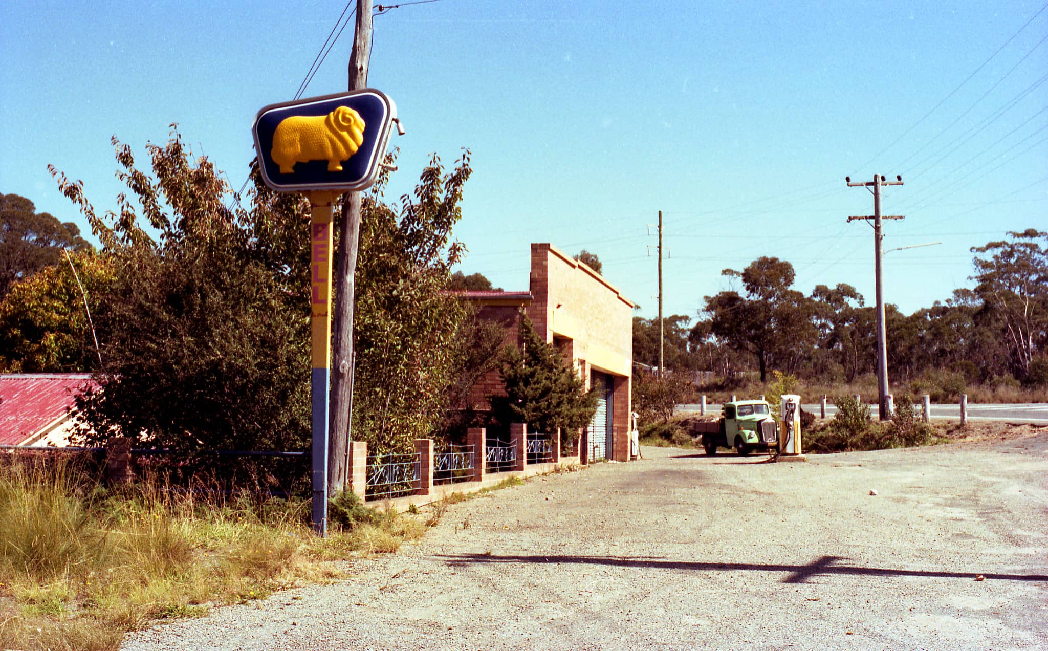
Bell (1067m)
A railway platform was opened here in 1875 with the name Mount Wilson. This was changed to Bell in 1889, in honour of Archibald Bell Jnr., of Richmond Hill, who discovered a route over Mount Tomah to the Cox’s River in 1823. This alternative route across the Blue Mountains became known as Bell’s Line of Road.
Mount Wilson
This location was surveyed by W. R. Govett in 1833. However, it was not until after 1867, when it was rediscovered by George Bartley Bowen and subsequently surveyed and subdivided by Edward Sanford Wyndham of the Government Survey Department, that the area was settled. In 1868 the Deputy Surveyor-General P. F. Adams, while visiting the survey camp, named the area Mount Wilson after the Minister for Lands John Bowie Wilson. The lots did not sell quickly until the opening of the Mount Wilson railway platform in 1875, within twelve months of which all the original blocks were sold.
Mount Irvine
It is claimed that those responsible for naming the mountain beyond Mount Wilson in the late 1860s mistakenly gave it this name in the belief that it was located within the parish of Irvine. It is actually in the parish of Bilpin. Another theory suggests that the name was given in honour of John Bowie Wilson, Minister for Lands at the time, who was born at Irvine in Ayrshire, Scotland, in 1820. Mount Irvine was not settled until 1897, when Charles Robert Scrivener, Basil Knight-Brown and Harold Morley each took up land there.
Source: John Low, Local Studies Librarian Blue Mountains City Library

